Desert Peaks - Region 9, Peak 4
Mexico
Generated on 10 Aug 2024 - see revision history - please send updates to the webmaster
| Cerro Pinacate in Mexico Region | |||||||||
| Num | Peak Name (more links) | Waypoint | Elev | DPS | Class | Pics and Reports | UTM hint (map) | 7.5' USGS topo quad | Register |
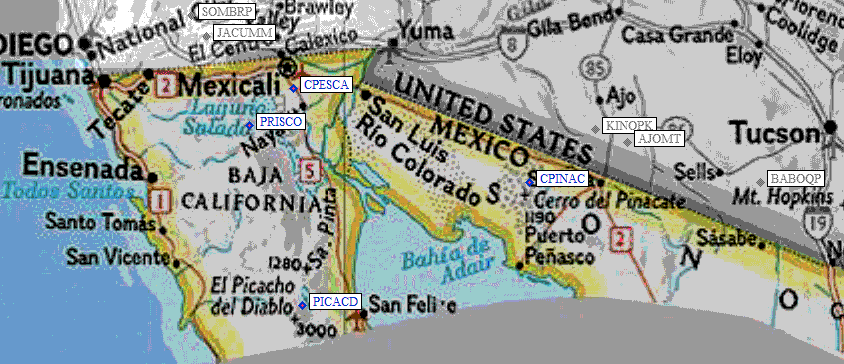
| 9.4 | Cerro Pinacate | CPINAC | 3957 | 1 | 1 report on pinacate | 634177 | Volcan el Elegante | ||
| Cerro Pinacate is at 31°46.5’N, 113°29.5’W. It is shown on the US Sectional Aeronautical chart, Phoenix, as a prominent unnamed point with an elevation of 3957’. It is also unnamed on the Mexican topo with an elevation of 1200+ meters. The code numbers for the auxiliary topos are H12A22, Sierra Blanca, and H12A23, Los Norteńos. | |||||||||
NOTE: M = Mountaineers Peak, E = Emblem Peak, X = not on DPS List (in 'DPS' column)
      ^ = metric contours and elevations on 7.5' maps (in 7.5' map columns)
      Name Mt  => 'Mt' is before peak 'Name' (ex: Rose Mt is Mount Rose, but sorted on 'Rose')
      Name Mtn => 'Mtn' is after peak 'Name' as listed (ex: Muah Mtn is Muah Mountain)
The "UTM Hint" in the table above approximates the peak location to the nearest 100 meters.
Click here for info on Universal Transverse Mercator coordinates.
Useful Links: