See the trailhead page for more maps and GPS Waypoints. All photos below are courtesy of Eve Laeger.
Oh, by the way... the 7.5' quad names 'Muddy Peak' where we climbed (waypoint MUDDYP, with just a label, 1642 meters) but also names a nearby and higher peak as simply 'Muddy' (waypoint MUDDYH, with a benchmark, 1655 meters). Have we all been climbing the wrong peak?
| The apparent 'trailhead' is waypoint MUDCAR, where you come upon an amazing steel plate sign, with arc welder lettering listing all the recreational and conservation groups that agree you should stop here. It's an easy 4WD road up to this point and beyond, but it does seem that most people stop where they are told. We walked west over a slight rise (waypoint MUDPAS) and continued down the old 4WD road into the drainage NNW of Muddy. | 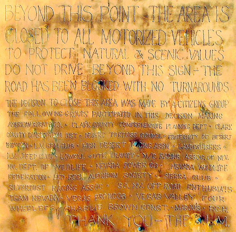
|
| The road branches and generally isn't much easier than walking cross country, which was how we shortened the route on the way back. Muddy is not the big cliff face you think it is - that's just the north shoulder and the peak is out of sight from the valley. We thought the guide we were following didn't characterize the saddle very well. Waypoint MUDSAD is the broad deep saddle west of the peak, shaded in this picture. It's the only obvious place to go, so just go there! | 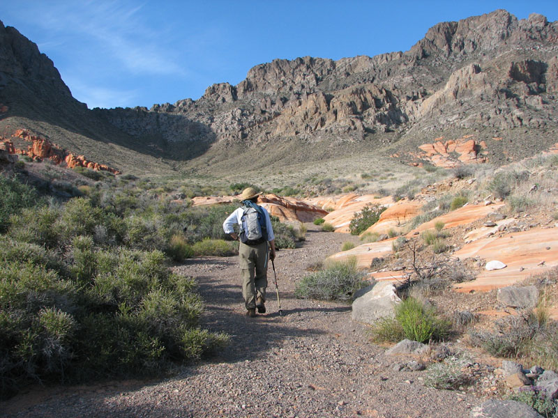
|
| The orange taffy outcroppings in this valley (and along the road driving in) are amazing. I suppose that's where the name 'Valley of Fire' comes from, although this route isn't technically in the park. | 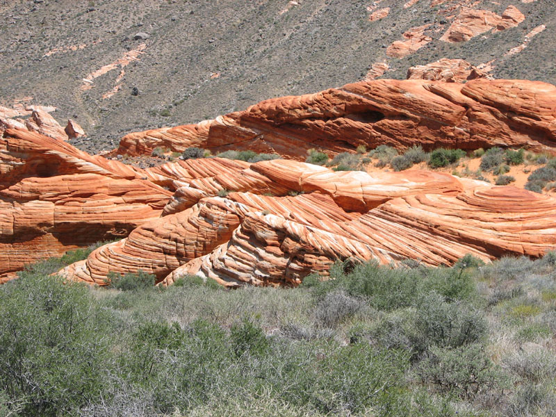
|
| From the saddle you can traverse up and south across the hardscrabble face, or you can go east to the point at the top of that cliff face you've been photographing from the valley floor. Either way it's a fun ridge run southeast toward the summit. We often dropped a bit on the west side of the ridge to avoid harder climbing. As you approach the summit mass there is real 3rd class in places, but the holds are solid (it's rock in spite of the name and the look of the peak - if you look carefully you'll find two of us in this picture) and soon you're on top seeing Lake Mead wrapping 180 degrees around the summit! | 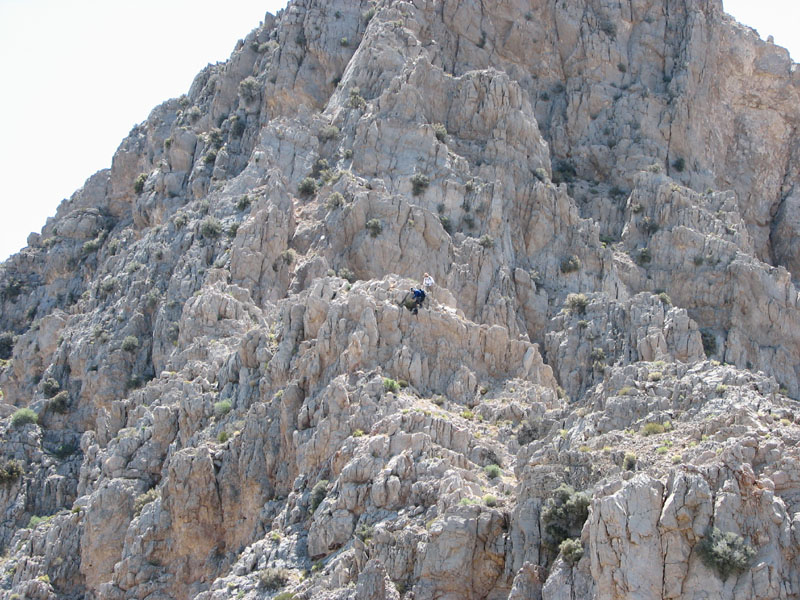
|
| It was a hot weekend, but the flowers were still out and we took time on the hike back to sightsee. This standalone formation has a hole in the center where rainwater has created a pretty good lawn. For scale, that's me standing on the right side. | 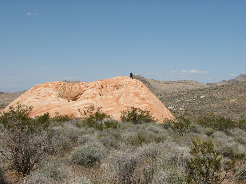
|
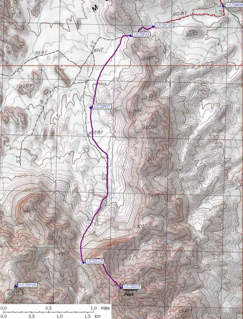
Hiking topo map: