Bear Box at Curry Area Backpacker Campground (YV01)
Generated on 20 Oct 2025 - see revision history - please send updates to the webmaster
Detail Map of waypoint YV01
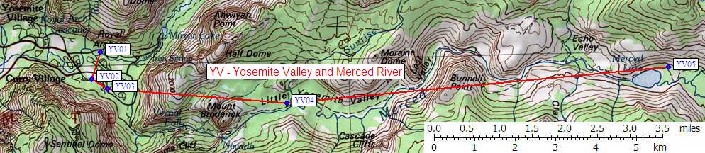
in Yosemite Valley and Merced River:
(scroll down for directions, waypoints, and area map)
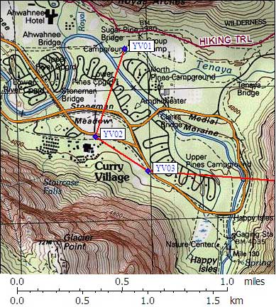
- YV01 is 23 large boxes, at about 4000 feet,
in the GPS route YOSEMITE VALLEY.
- Directions from Kevin Freer, with GPS waypoint, Sep 2006:
At Curry Village the backpacker's campground is northwest of North Pines Campground.
It is signed as 'Backpacker's Campground' from the top of North Pines Campground.
There are 23 large bear boxes here, although number 19 is reserved for park volunteers.
To get to the campground from the Sugar Pine Bridge (cycletrack route),
go approximately 20 yards east of the bridge and turn right (south)
on a footpath to the right and go another 20 yards to the campground.
To get to the campground from the valley road, take the free shuttle bus to
stop 16 (the entrance to North Pines Campground), then walk northwest
on the campground road by the river. At the northwest end of
the campground you will reach Tenaya Creek. Instead of fording
the creek, continue following the campground road around to the right
(east) for about 30 yards and you reach a signpost pointing left (north)
to the backpacker's campground and 'Valley Loop Trail'. This path takes
you to a bridge with the campground just on the other side (about 100 yards
from the signpost to the edge of the campground).
- YV01 coordinates: (see GPX waypoint download links above)
  (lat,lon) = (37.7439300, -119.5678500) in decimal degrees, NAD83.
  (zone,east,north) = (11S, 273831.0, 4180310.0) in decimal meters, NAD27.
- Scroll down for a regional map of the entire Yosemite Valley and Merced River region.
Map exported from TOPO! software, used with permission.
Useful Links: