Bear Box at Lower Funston Meadow (KC01)
Generated on 20 Oct 2025 - see revision history - please send updates to the webmaster
Detail Map of waypoint KC01
in Kern Canyon:
(scroll down for directions, waypoints, and area map)
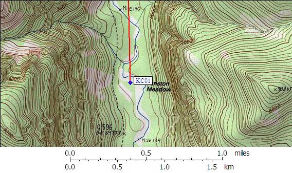
- KC01 is 2 large boxes, at about 6500 feet,
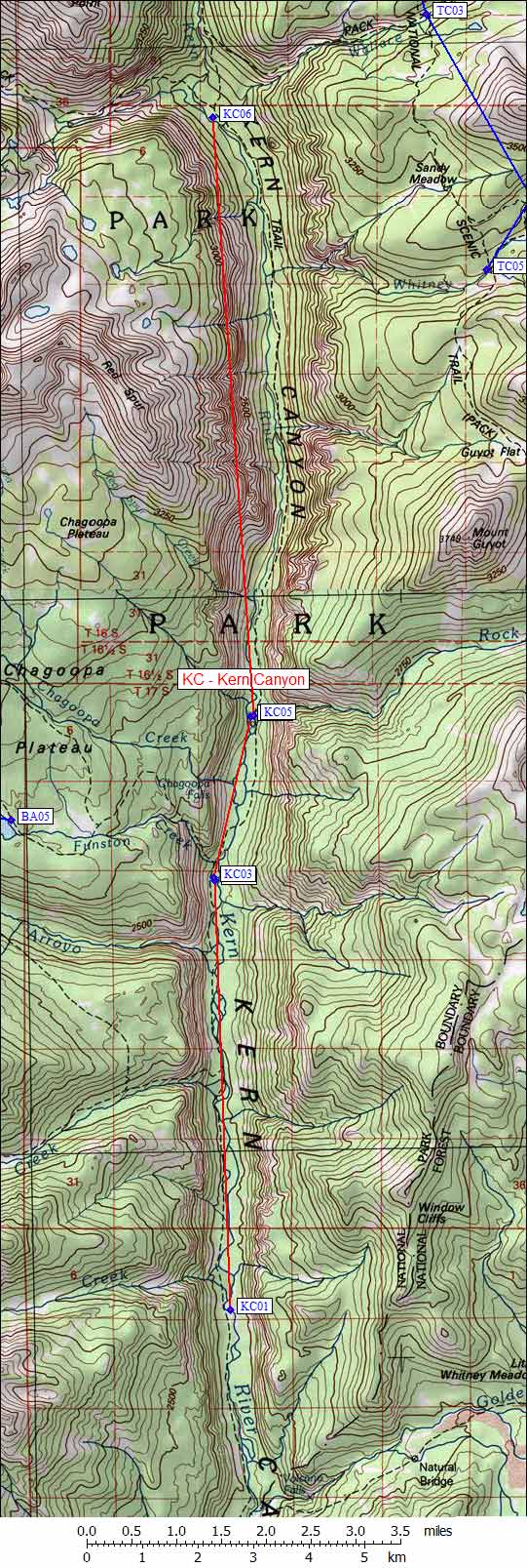
in the GPS route KERN CANYON.
- Note: This box is near where Laurel Creek joins the Kern River,
south of the Big Arroyo and Rattlesnake Creek trail junction.
The map does not show Lower Funston, but it does show plain old
Funston Meadow about 5 miles south of Upper Funston Meadow.
- Directions from Mark Sapiro, with GPS waypoint, Sep 2006:
Follow a spur trail marked with a sign 'campsites' to the east.
There is a campsite and two new style large boxes.
- Directions from Mineral King ranger info sheet, dated 1991:
The bear box is 200 yards east of the Kern Canyon Trail, at a campsite in
the forest between the northeast corner of Lower Funston Meadow and the Kern River.
Best access by stock or foot is down a steep embankment from the trail to
the meadow's edge, near the SOUTH end of the meadow, then north and east
along faint paths in the grass to the camping area. A prominent access
route near the north end of Lower Funston Meadow is usually wet and boggy.
- KC01 coordinates: (see GPX waypoint download links above)
  (lat,lon) = (36.3824700, -118.4102400) in decimal degrees, NAD83.
  (zone,east,north) = (11S, 373591.0, 4027099.0) in decimal meters, NAD27.
- Scroll down for a regional map of the entire Kern Canyon region.
Map exported from TOPO! software, used with permission.
Useful Links: