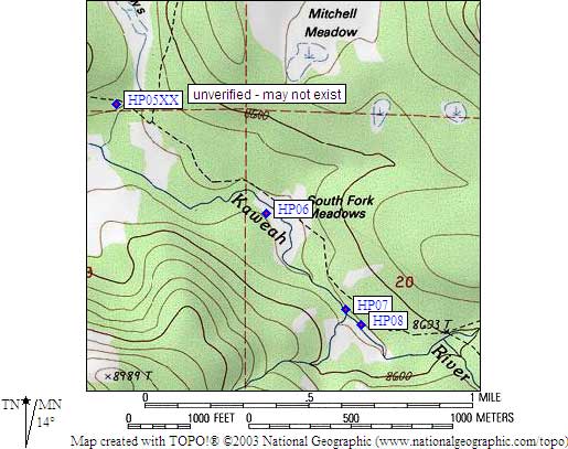
Bear Box at Hidden Camp / Sand Meadow (HP05XX)
Generated on 20 Oct 2025 - see revision history - please send updates to the webmaster
WARNING!
"XX" in this waypoint name means the coordinates and elevation are approximate!
Please contact the webmaster if you can help verify this box.
Detail Map of waypoint HP05XX
in Hockett Plateau:
(scroll down for directions, waypoints, and area map)
- HP05XX is an unknown type, may not exist, at about 8500 feet,
in the GPS route HOCKETT PLATEAU.
- Note: This box may not exist! Waypoint is a complete guess!
- Directions from Steve Eckert, June 2001:
No location description was available from rangers.
I was unable to locate any developed camp or bear box in this area,
so 'Hidden Camp' may in fact be somewhere else, or it may have been removed.
I walked the trail toward Touhy Creek, toward Hockett Lakes,
and I went cross country down Sandy Mdw and across between
the two trails. There are plenty of fine campsites in big
trees between wet meadows, just no bear boxes or developed
campsites that I could see.
- Directions from Mineral King ranger info sheet, dated 1991:
One box on the north side of the river and about one fifth of a mile
south and west of the southern end of Sand Meadow.
- HP05XX coordinates: (see GPX waypoint download links above)
  APPROXIMATE  (lat,lon) = (36.3517100, -118.6529600) in decimal degrees, NAD83.
  APPROXIMATE  (zone,east,north) = (11S, 351761.0, 4024031.0) in decimal meters, NAD27.
- Scroll down for a regional map of the entire Hockett Plateau region.

Map exported from TOPO! software, used with permission.
Useful Links: