Bear Box at East Horse Lot at Road's End (CG05)
Generated on 20 Oct 2025 - see revision history - please send updates to the webmaster
Detail Map of waypoint CG05
in Cedar Grove Area:
(scroll down for directions, waypoints, and area map)
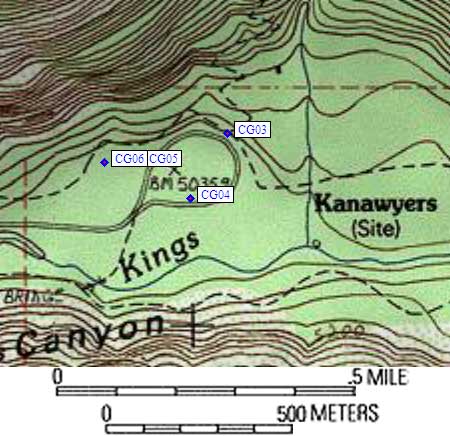
- CG05 is one large box, at about 5000 feet,
in the GPS route CEDAR GROVE.
- Directions from Steve Eckert, with GPS waypoint, July 2004:
One large box on the uphill side of the main horse trailer parking
lot at Road's End. This is the lot just west of the Copper Creek
trailhead (north loop, or backpacker parking), and to reach it
you have to go all the way around the Road's End loop, turning
right just before finishing the loop. (There is a west parking loop
which is joined to this one, but THIS lot is the one which is directly
accessed from the loop road.)
- CG05 coordinates: (see GPX waypoint download links above)
  (lat,lon) = (36.7955800, -118.5859000) in decimal degrees, NAD83.
  (zone,east,north) = (11S, 358591.0, 4073171.0) in decimal meters, NAD27.
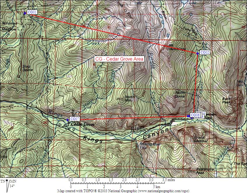
- Scroll down for a regional map of the entire Cedar Grove Area region.
Map exported from TOPO! software, used with permission.
Useful Links: