Bear Box at Copper Ck Jct Road's End (CG03)
Generated on 20 Oct 2025 - see revision history - please send updates to the webmaster
Detail Map of waypoint CG03
in Cedar Grove Area:
(scroll down for directions, waypoints, and area map)
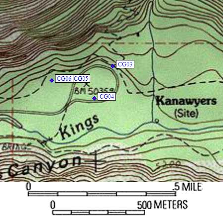
- CG03 is four large boxes, at about 5000 feet,
in the GPS route CEDAR GROVE.
- Note: As of 2004, the rangers say the southern parking loop (near the
river) is for day use only. Backpackers must park in the northern
loop and must have a car pass (issued with your permit). There were
no signs to indicate this, and no obvious enforcement, but watch out!
- Directions from Steve Eckert, with GPS waypoint, July 2004:
Four large boxes just uphill from the most northern parking loop,
where the Copper Creek trail meets the pavement, at Road's End.
- Directions from 'pctPacker', Dec 1999:
Four large bear boxes in the middle of the northern parking loop
at Road's End (not the permit kiosk parking loop, the other one)
roughly 5 miles east of Cedar Grove.
- CG03 coordinates: (see GPX waypoint download links above)
  (lat,lon) = (36.7962900, -118.5832100) in decimal degrees, NAD83.
  (zone,east,north) = (11S, 358832.0, 4073246.0) in decimal meters, NAD27.
- Scroll down for a regional map of the entire Cedar Grove Area region.
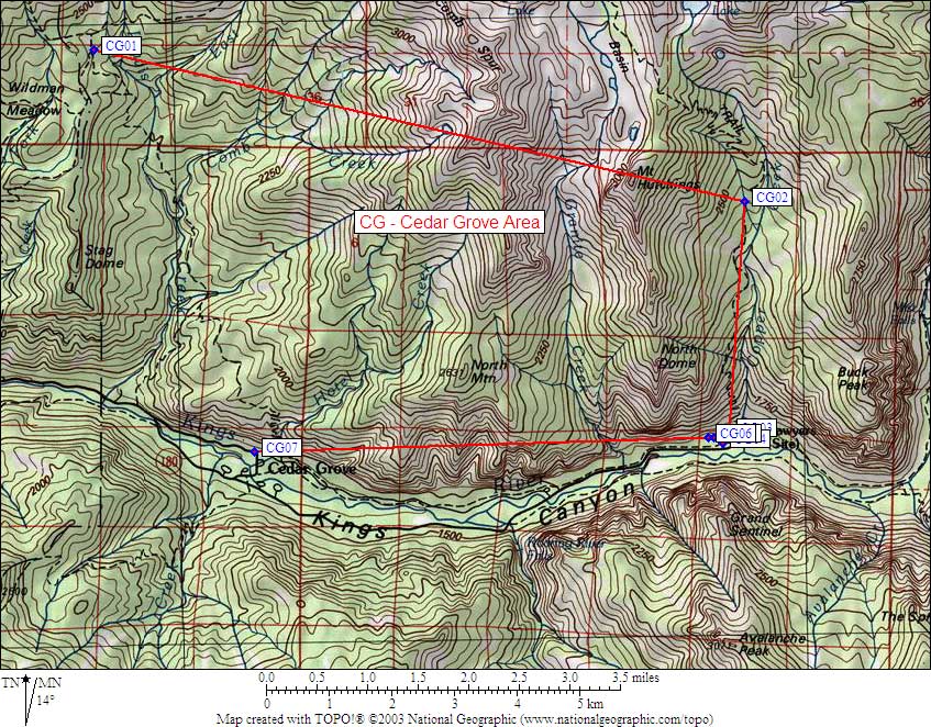
Map exported from TOPO! software, used with permission.
Useful Links: