Bear Box at East Lake North Outlet (BC10)
Generated on 20 Oct 2025 - see revision history - please send updates to the webmaster
Detail Map of waypoint BC10
in Bubbs Creek Southern Rae Lakes Loop:
(scroll down for directions, waypoints, and area map)
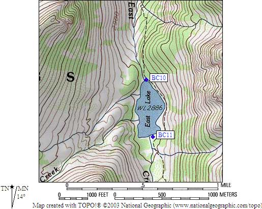
- BC10 is a standard box, at about 9500 feet,
in the GPS route BUBBS CREEK.
- Directions from Scott Sullivan, with GPS waypoint, Sep 1999:
One standard box at the north end of the lake,
easy to spot in a well established camp area,
several hundred yards west of the trail - DON'T cross the outlet stream.
- Directions from Mineral King ranger info sheet, dated 1991:
One box at the lower end of East Lake.
- BC10 coordinates: (see GPX waypoint download links above)
  (lat,lon) = (36.7289000, -118.4437100) in decimal degrees, NAD83.
  (zone,east,north) = (11S, 371163.0, 4065575.0) in decimal meters, NAD27.
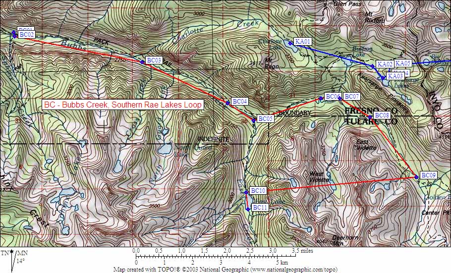
- Scroll down for a regional map of the entire Bubbs Creek Southern Rae Lakes Loop region.
Map exported from TOPO! software, used with permission.
Useful Links: