Bear Box at Lower Junction Meadow Bubbs Ck (BC04)
Generated on 20 Oct 2025 - see revision history - please send updates to the webmaster
Detail Map of waypoint BC04
in Bubbs Creek Southern Rae Lakes Loop:
(scroll down for directions, waypoints, and area map)
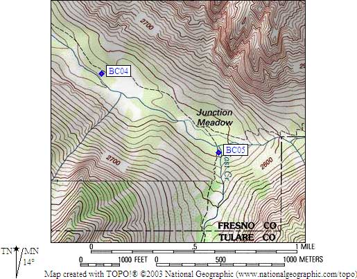
- BC04 is a standard box, at about 8100 feet,
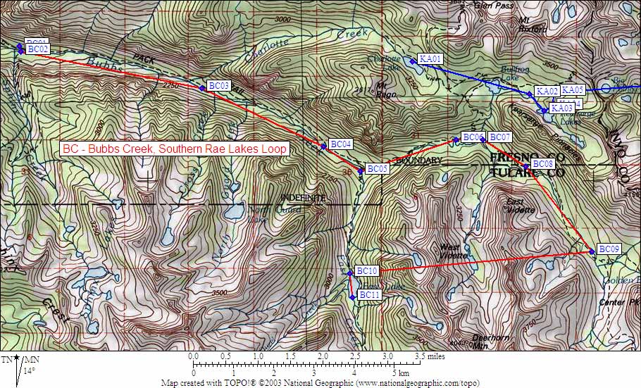
in the GPS route BUBBS CREEK.
- Directions from Steve Eckert, with GPS waypoint, August 2004:
One standard box about halfway between the trail and the stream,
in a rocky open area roughly 100 yards west of the livestock
drift fence. There is a small sign just east of the box location.
- Directions from Mineral King ranger info sheet, dated 1991:
One box below the Bubbs Creek trail in Lower Junction Meadow.
- BC04 coordinates: (see GPX waypoint download links above)
  (lat,lon) = (36.7574500, -118.4508700) in decimal degrees, NAD83.
  (zone,east,north) = (11S, 370574.0, 4068750.0) in decimal meters, NAD27.
- Scroll down for a regional map of the entire Bubbs Creek Southern Rae Lakes Loop region.
Map exported from TOPO! software, used with permission.
Useful Links: