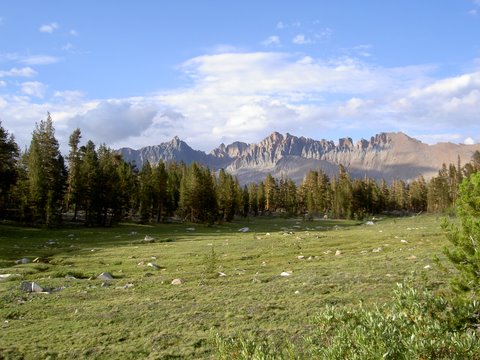
LOST CANYON
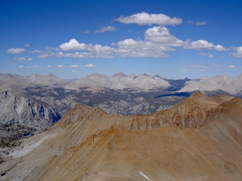
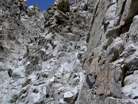
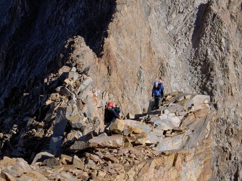
We left camp at 6:00 AM, summited at 10:30 AM. To get to the base of the peak, we traversed into the next basin to the north around the spur that descends from the southwest ridge of Black Kaweah, staying at 11,500 feet, our camp altitude. Ruth wasn't feeling well and stayed behind. From the lake at xxx feet, you will see a seeming maze of chutes leading to the summit. The right hand chute is where you start, and you quickly transition to the left hand chute. The left hand chute is steep and CL4 in the lower sections. The key to finding the starting point is to see the small black waterfall stain in the lower chute, and about 20 feet below it, a 'flat' white granite slab, about 10 feet wide and 25 feet long (EL approx. 12,500). That flat granite slab is where you go to start. You climb up large talus boulders above the small twin lakes at XXX feet to get to the starting slab. From there, there is a clear ramp leading to 30 feet of CL3, then another ramp that wraps around the buttress to the left hand, main chute (EL approx 12,750).
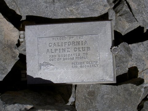
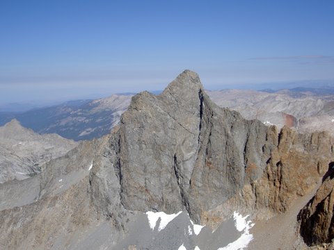
Once in the main chute, the route will be obvious, and you will encounter five stair steps (waterfall pitches), ranging from 10 to 30 feet high (the first at EL approx 12,800). All are easily climbed, with low CL3 moves, and the rest of the chute remains at CL2. There is lots of loose rock, but not as bad as some peaks (Disappointment comes to mind), and the handholds were good. We stayed to the left for the most part, although one is also passed on the right. At the fourth stairstep, you'll come to a CL5 vertical wall, and the chute will jog over to the left (EL approx 13,100). There is a gravel ramp, with a square black cave at the top. We climbed the ramp, did a stemming move to get above the black cave, and then continued up the ramp. At the highest stair step, there is a tricky CL3 move (which you wouldn't want to downclimb). This can be passed by going left, over a small horn, which leads above the chute and then drops back into it. At this point, the summit block will be in sight. Below the summit block, follow a short, narrow ramp to a small gendarme at the top of the chute. From the small gendarme, it's an easy CL3 move to the summit. The register dates back to 1920, although it was placed in 1924 and annotated back to the earlier date. Amazingly, the register was precariously perched on the summit block, not even glued or bolted down. I spent some time making a secure spot for it, bounded by rock on all sides. The views are fantastic all around, and we got a good view of the route up Red Kaweah. We spent a very leisurely hour on the summit, reading the register and enjoying the view. We downclimbed both chutes, and by 2PM, we were sunning ourselves and napping on a big flat rock, perfectly sized for 3 people. We were back in camp by 5PM. We called this our 'rest day'.
RED FROM BLACK
Black's register box
THE MAIN CHUTE
Another 6:00 AM start, and we summited at 9:05 AM. We gradually climbed over tundra and talus to the base chute. Red Kaweah has a very obvious main chute, CL2, which splits into two chutes near the top. We found it best to take the left hand chute up, as it had less loose rock and we were able to stay on the buttress that divides the left and right hand chute and found good CL2 boulder climbing. At the top of the left hand chute, you'll traverse right into the top of the right hand chute. A look at the loose rock and scree in the right hand chute told us that we'd made the right decision. You'll see what looks like a low CL3 wall, but this is easily avoided by following a shallow, broad ramp to the right. Before you drop into the imaginary dividing line of the drainage to the south, you'll head east, up a low CL3 move to the summit plateau, actually a 20 degree CL2 talus and boulder field. From there, follow the north ridge to the summit. The register on the summit dates to 1936 to 1987, and there is a newer register as well. We had a fantastic view of the peaks along the ridge from Black to Red Kaweah. We left at 10AM, and were back in our high camp at 11,500 by noon. We packed up, and downclimbed to the Big Arroyo. At this point, it started to rain gently, and we managed to stay mostly dry on the trail to Little Five Lakes. On the way, we met the Ranger, Martin Oliver, who was stationed there. On the trail just below the lakes, we smelled frying fish, and ran into Ruth, who had hiked out a day earlier. She had just caught 5 large trout, and was enjoying them, pixie like, under a tree while a gentle rain fell. She offered to share, and we enjoyed some of the best fish I've tasted. We checked out the ranger's yurt, and shared wildflower sightings.
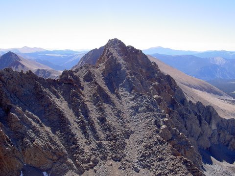
Red Kaweah North Ridge
Black from Red
Ranger's front yard
Datum,North America 1983,GRS 80,0,-1.6E-7,0,0,0
RouteName,1,KAWEAHS
RP,D,TRAILJ,36.45612,-118.58601,08/14/2008,18:40:02,OLDNEW TRAIL JCT
RP,D,SWTRAL,36.45651,-118.56780,06/17/2008,14:29:57,
RP,D,GLACPS,36.46408,-118.56771,08/14/2008,18:40:02,
RP,D,HANDKN,36.47409,-118.54721,08/14/2008,18:40:02,
RP,D,CAMP11,36.53095,-118.51722,08/14/2008,18:40:02,
RP,D,CAMP80,36.52941,-118.51694,08/14/2008,18:40:02,
RP,D,KAWEAB,36.54530,-118.51615,08/14/2008,18:40:02,