| The 10-year history of Climb-O-Rama's: | ||
| 1996 | Great Western Divide | first trip named 'Climborama', over Shepard Pass to Milestone Basin |
| 1997 | Climborama 97 | a decentralized affair in the Evolution region |
| 1998 | Duke Newcomb and the 16 Peaks | the most prolific Climb-O-Rama ever, in the Whitney area |
| 1999 | Mosquito March '99 | subgroups forming and dissolving from Taboose Pass to Cartridge Pass |
| 2000 | Climborama V | rain and hail ended this Kearsarge Pass and Center Basin trip early |
| 2001 | Climb-O-Rama 2001 | Crowd-O-Rama had a very large group, from Bear Creek to Lake Italy |
| 2002 | Lawd Have Merced | a one-way congenial trip from Yosemite Valley to Tuolumne Meadows |
| 2003 | From Roaring to Lion (The Triple Trip) | our exit was blocked by a forest fire on this Colby Pass area trip |
| 2004 | WESTERN Great Western Divide | unrelenting bad weather on the seldom-visited side of the Milestone Basin |
| 2005 | Climb-O-Rama X (Black and White) | horses made the approach to Blackcap Basin and White Divide easier |
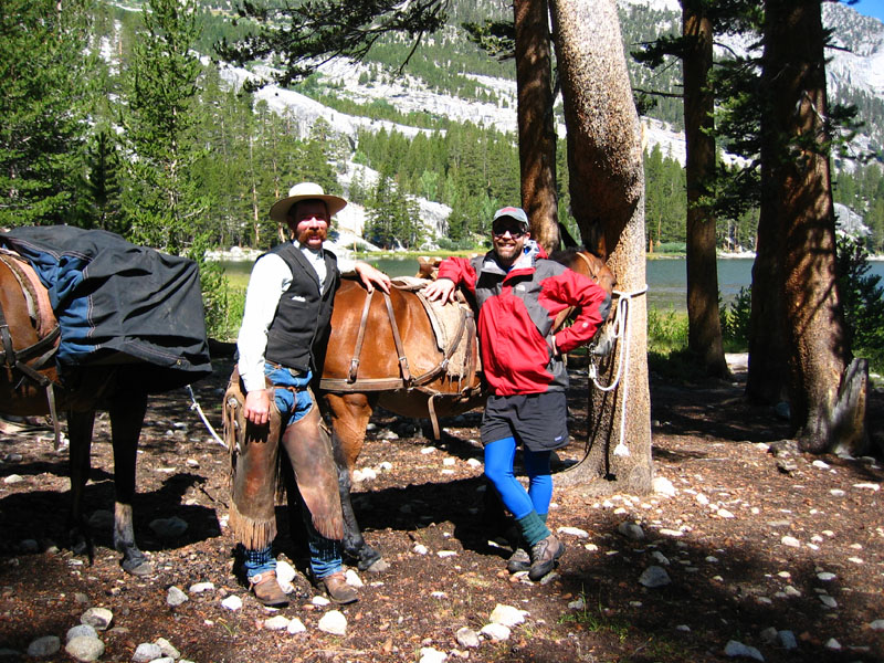
| A real contrast between old and new. Here I am in my synthetic hikerdude clothes, and the packer (David) is wearing blue jeans and a wool vest (not to mention those chaps and the mustache). We had a blast comparing experiences! | 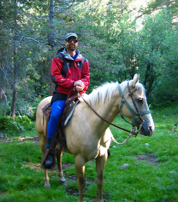
|
We left Junction Meadow late because that's how it's done with horses. I was supposed to walk up to East Lake with my day pack and have my full pack delivered, but since an empty saddled horse was being taken up to bring down a paying client, David invited me to hop on. I'm no horseman, I've only done short resort rides, but I couldn't say no.
After repacking and trying to convince the downward-bound packer clients that those puffy clouds wouldn't STAY puffy (they packed away their rain gear) I headed up to Lake Reflection to scout around and drop off a cache of climbing gear and food. The cache wasn't really necessary, but it meant I'd be climbing with a smaller pack the next day and we wouldn't have to scout the route.
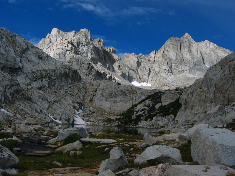
| Lake Reflection never had a reflection due to the wind, but it's nice anyway! | 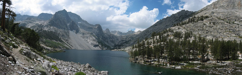
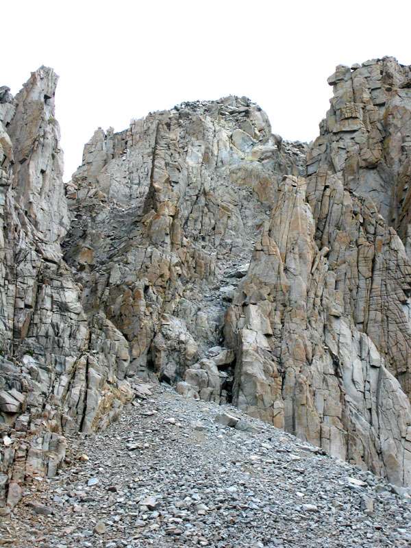
| Lucy's Foot Pass is the trail around the left, our route was around the right to avoid cliffs and talus. |
There are really great campsites about 500' elevation above East Lake, with slabs and streams and good forest, but I was supposed to meet the rest of the group that evening back where the packer dropped me off. I got a couple hundred feet above Lake Reflection in a couple of hours and stopped for lunch. It looked like rain. No, it looked like snow. I had walked a bunch of slabs around the lake and I was worried about traction on the way back. I headed down about 2pm but got caught in a storm. Hail that piled up, wind, rain, thunder, and I was starting to think I should bail off the trip. This was at least the 4th day of rain and it didn't look like it was over. Did I mention the Cedar Grove road had washed out in a downpour on Thursday?
The others showed up at East Lake around 5pm to find me in my bivy with a tarp tied to a tree so I had a dry place to cook. It quit raining before dark but stayed very wet overnight with a heavy dew.
| We gave up on the weather and turned around, deciding to end our trip early.
Of course it cleared up once we headed down, so we talked about
shortening our itinerary and letting that afternoon's weather
determine whether we went back up or not. We snoozed away the
afternoon camped on a great grassy bump near the southwest end
of Lake Reflection - in mostly sunny conditions.
No more rain after noon. And a good sunset! But we should have climbed higher after all. |
| We climbed Mt Jordan by heading west from the lake, and then south to the west face chutes. From the lake you must drop 150' to avoid cliffs. It's best to stay on the rib NE of the lake, then drop down below two small lakes. Great scenery here, but soon the footing gets bouldery and tedius. |
There was some discussion as to which chute on Jordan was the right one. We did NOT take deep narrow chute that curves left as it reaches the summit ridge, choosing to stay left in a broader chute which tops out at the first saddle south of Point 4048m (visible on the 7.5' topo, NAD83 36.6841,-118.4495). We traversed south on the east side of the ridge around two low bumps and the summit mass, dropping a total of 100' as the route went from 2nd to 3rd class.
| The summit block is either a dangerously exposed step-across from a neighboring pinnacle,as Aaron is doing in this picture from the 1996 climb, or a layback friction move along the right edge. Not really class 4 because here are no handholds along the way, it's too smooth to friction with Vibram soles at the bottom, and the (lower angle lumpy) friction at the top doesn't lend itself to confidence or safety. | 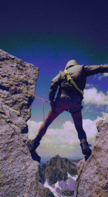
| The big problem for us was that we couldn't figure out how to protect the summit from below. (Last time I was here I had a top rope belay and did the step-across on the way up, then rapped off. No idea how the top rope was set up.) I climbed down and walked all the way around the summit blocks (three enormous slabs just leaning against each other) looking for some way to toss a rope over the top securely. The first person would have to free climb it and no one volunteered. |
With incoming dark clouds, wind, and temps dropping quickly again, we bailed rather than try too hard for that last 10 feet. Of course the sun came out as soon as we left the summit area.
At around 12.5k while descending the west chute, Chris undermined a big boulder that went 20' down the chute with him. He tumbled a couple of times, split his climbing helmet in the back and gouged it in the front. No one is sure, but the crack implies to me that his head got between a couple of rocks, not just got hit by a rock. They're hard to crack! He tore his jacket and bruised his arm, but there was no serious injury except to his pride.
| The west side of Longley Pass is Sound of Music country, with grass and flowers amid the big rocks (nice!). There is good footing all the way down this drainage, compared with loose footing on the east side of the pass, so it's better to go in other direction (up the grass and down the sand) as several other groups and solo climbers were doing. We dropped into Cunningham Creek, the drainage from South Guard Lake, then went south and east around a ridge at 11k into the unnamed drainage west of Thunder Mtn. |
Footing remains good past the first of three lakes, then becomes boulder hopping. Richard decided he had enough boulders at this point, and headed out via Sphinx Lakes while the rest of us filled water and hopped boulders up to West Thunder Pass. The only trick was to traverse between cliffs above the east end of the highest lake on a grassy ramp.
| We camped at glacial lake about a quarter mile south of West Thunder Pass. Camp was high (11.8k) and the lake was silty (several feet of ooze under the beautiful cobalt water if you tried to wade in) but the air was surprisingly warm. The sun came back out and we had a very pleasant evening with time to wash up and explore the nifty cracked-granite onion skin formation (which looked kind of like fallen dominoes). | 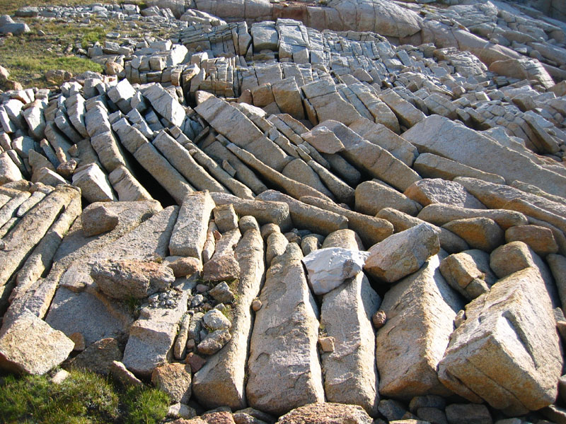
|
| Secor's book says to climb "the easternmost chute on the south side of Table Mountain's west ridge" and we had a long discussion about which of the chutes was the easternmost. Let me make it simple: There are two branches of the eastern chute which feed the same talus fan (splitting at about 12.7k), as shown in this picture. The left branch is technically not the most eastern, but it's the correct one. Both branches go as third class, but the right branch starts with 30' of hard climbing while the left branch starts easy but looks like there's a hard chockstone about 100' above the split. It turns out that the chock isn't hard at all! Take the left branch. |
The left branch dead ends before you reach the west ridge, only about 200' above the split between the branches. That's where Secor's book refers to a traverse 100' below the crest, I think, but just go to the dead end and turn right. There's a horizontal class 2-3 ledge that leads to the top of the rib between the branches. Traverse to the far right side of the other branch and go up past a hard spot (which now has a rap sling on clean rock beside the polish and rubble in the chute). It gets easier all the way to the top from here. The chute tops out at the westernmost lobe of the summit plateau, roughly in the middle of that plateau.
The route we did (which Secor calls the "south side of the west ridge") never actually reached the west ridge. We thought it could be more accurately called a west face route instead. Once we were at the top we saw other ducks, apparently at the top of the "north side of the west ridge" route. It's possible the north side route DOES follow the west ridge at least briefly - but I'm not really sure.
| We were back to our packs at 2pm, it was again threatening to rain and already raining elsewhere, but we stayed mostly dry. We packed down Table Creek on good footing and over Talus Pass on slabs and endless boulders. We turned uphill toward Talus Pass around 11.3k, before reaching the nice big meadow at treeline on Table Creek. We camped at Lake 11253 since Talus Lake was, well, all talus! Sure enough it threatened to rain on us and did rain elsewhere, but it seems we were always in the right place this day if you ignore a few sprinkles. | 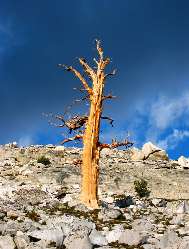
| Tree line has moved down the mountain since this giant was alive: |
| Secor's book says to leave the chute above a buttress, but there's no real need to do that. Just keep climbing above the notch Secor refers to and you'll find that the SW ridge is clean and airy class 2-3. You must drop a few feet below one obstacle right at base of summit mass, then turn up through huge blocks directly to the summit. If you traverse behind the buttress, you'll end up on the loose talus slope you see in the left of this picture: | 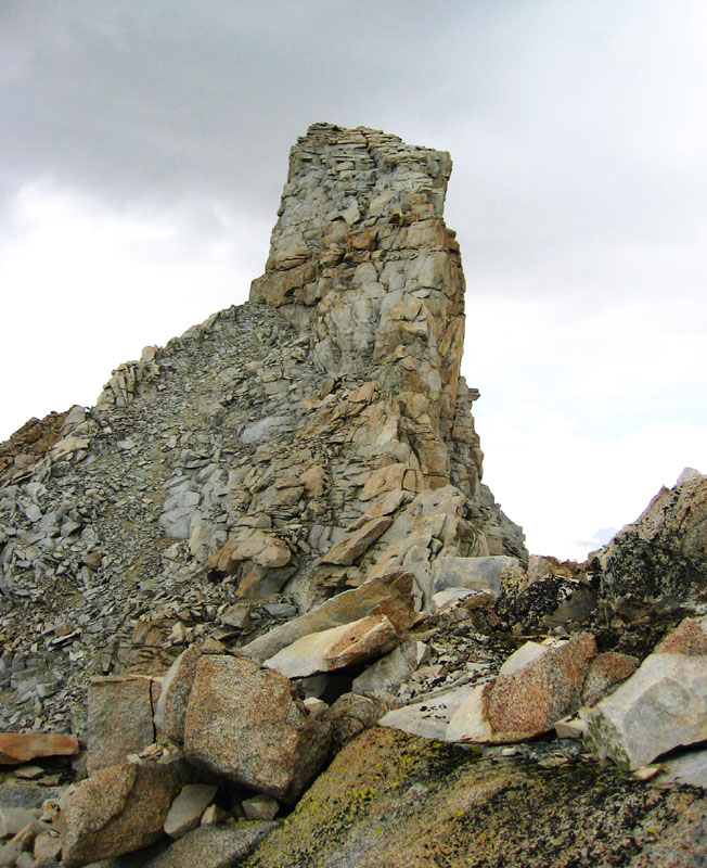
| This is a picture of the summit from that ridge. I think we basically climbed up the crack that appears in the middle of the pinnacle. |
We enjoyed our time on top, but it was raining to the east and to the west. Then it started raining in the south, then it came across at us from the east. Finally I convinced the others to start downclimbing, but the die was cast. Rain and hail hit while above the black stains and we slowed to a crawl. Slabs became waterfalls and the lichens remained deadly slick even during a brief pause in the rain.
Just as we exited onto 2nd class the serious storm hit. The raging wind created whitecaps on the lake, the hail got to over quarter of an inch, and lightning was a reminder of how badly the day could have gone if we were still on the summit. The others hid under a rock, I scurried back to camp (arriving about 4pm) and dove into my bivy bag.
| The valley disappeared in sheets of hail as the most violent storm of our trip sat on us for an hour. It dumped several inches of hail, most of which melted quickly, but some of which was still there next morning. This picture was in mid-August, not November! Waterfalls appeared on the slabs around me, and I ended up laying in over an inch of water. Let's have a big round of applause for Outdoor Research bivy bags - the most watertight shelter I've ever had. I stayed dry in my down bag. |
| Up early, we were on top of Midway at 10am under growing clouds. We congratulated ourselves on doing the peaks in this order because Milestone was now unclimbable with snow on all the 3rd class holds. Midway is a sand-and-boulder trudge with a great view from the top. (Both Midway and Milestone would be easily doable on the same day if you started either at Lake 3512m or even at Colby Lake and didn't have to avoid afternoon storms.) | 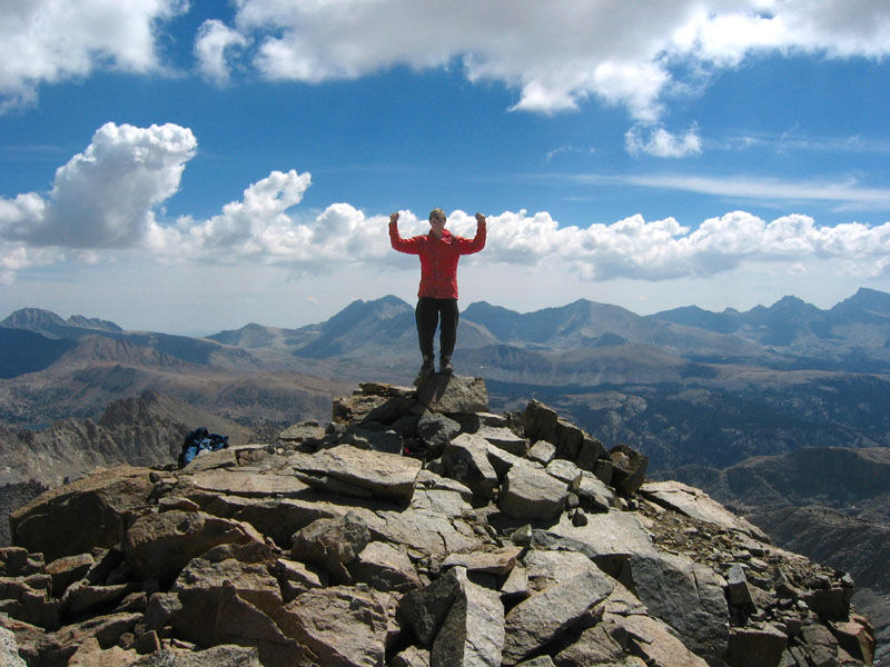
|
With storms every day, growing in intensity, we opted for an easy descent to Colby Lake instead of our intended cross-country return. Thunder, Brewer, North Guard, and Farquhar would have to wait for other trips. We stayed northwest of Lake 3512's outlet stream, mostly in tundra and duff all the way to the trail around Colby. After the required "ooh and aah" stop near the outlet, we scampered down the trail toward Whaleback and Big Wet Meadow as the storm closed in behind us. We received only sporadic sprinkles and made it down around 8600' where we camped in a developed horse camp somewhere near Cement Table Meadow.
It's worth mentioning that after building a fire and starting dinner the sound of birds and water was overwhelmed by racous laughter and the thump of hooves. The clients were upset they didn't get to kick us out, but the packers were gracious and moved up-canyon to another site. Still, the horses and mules were used to getting fed here every morning, so they woke us up milling around. When they didn't get food, they went and stood at the hitching rail as if they had been tied up. Rather amusing to watch!
| There was early sun as we hiked down to Roaring River Ranger Station, then luckily the clouds arrived to cool us on the grind up to Avalanche Pass. | 
| The trail over Avalanche looks seldom travelled, and seems to climb forever from Roaring River Ranger Station. Warren tells me he once took some Boy Scouts on a cross-country traverse that avoided some of the gain, but we were playing it safe. |
The rain started while we were on the Bubbs Creek switchbacks, and got heavy around the steel bridge across Bubbs Creek. We heard continuous thunder every second of the last two miles back to the cars. It was never silent - something I've never experienced this long and this continuously before. Rain and hail fell at 5k, and tourists were still hiking uphill in the rain thinking it was a simple afternoon squall. (Later they came running downhill wet and with no warm clothes.)
It quit raining by 7pm, just after we reached the cars. Since I had recently discovered the public showers at Cedar Grove I became civilized and the search for a restaurant started. Skip the Hummingbird if you can find it.