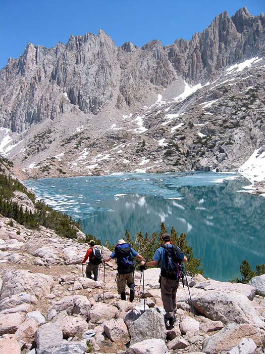
The hike first traverses the south shore of Lake Sabrina, with distant views up towards the peaks of the Evolution Region. The king daddy of the Evolution peaks -- Mt. Darwin -- is not visible for the first few hours of the hike, blocked by other peaks. However, we had fine views of Mount Haeckel, Mount Wallace, Picture Peak and the red-hued Paiute Crags. The steep climbing begins towards the end of Lake Sabrina, where the trail angles upward to leave the main drainage and gain the hanging valley that holds Blue Lake.
At Blue Lake we got our first view of Thompson Ridge, Mount Thompson and its glacier (2.3 miles, +1,200' from the trailhead). From there, it was another 1.5 miles and 600 feet to Baboon Lakes. The trail is very difficult to follow through here, and of course we promptly lost it. What trail does exist ultimately fades out among the slabs below Baboon Lakes, resulting in a mild bushwack and routefinding challenge.
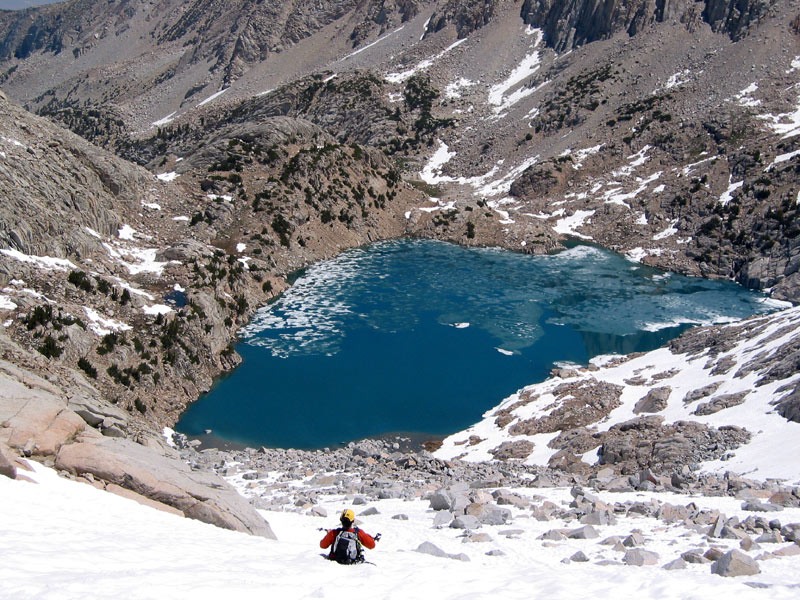
At Baboon Lakes (10,976') we had an even better view of the Thompson area, but Mount Powell was still hidden behind lower foreground peaks. We navigated our way around the northeast side of Baboon Lakes (recommended), which involved some ups and downs, but not as bad as the other shore (which we took on the way out -- not recommended). From the lake outlet, we began following the stream up valley towards our intended campsite at Sunset Lake. (People heading for the glacier who are *not* camping at Sunset Lake should not follow the drainage up to Sunset Lake. Instead, they should angle right and cross through the obvious gap due north of Sunset Lake and contour above its northwest shore en route to the glacier). We arrived at Sunset Lake (11,464') in one piece and promptly found a perfect campsite on some slabs above the northeast shore of the lake (incidentally, during our trip we saw no other people above the first of the Baboon Lakes, despite the beautiful weather and fine conditions).
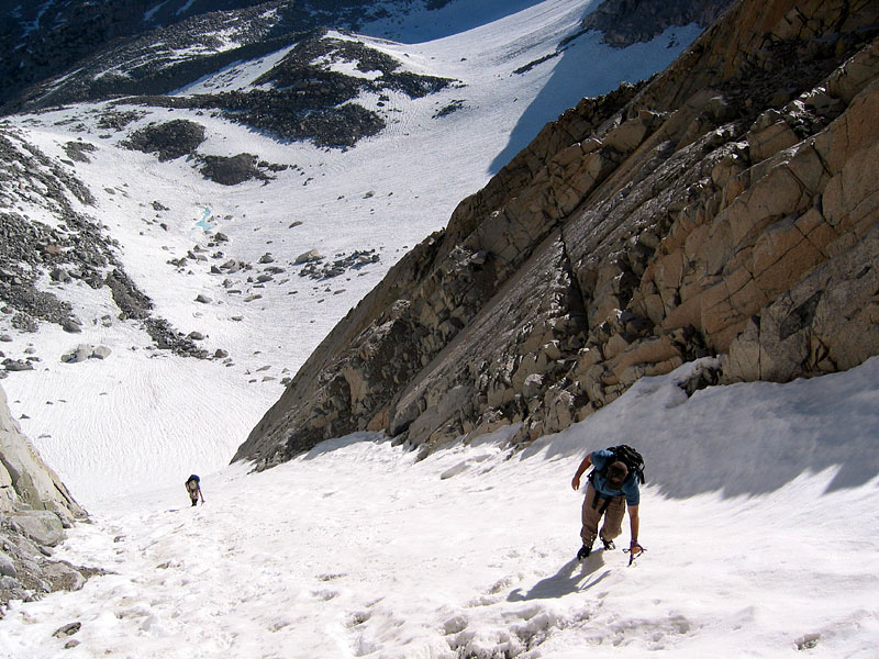
Up early the next morning, we left camp at 6am and hiked along the right hand shoreline of Sunset Lake, then climbed the snowfield to the Thompson Glacier. The top 1/2 of the Thompson/Powell col was dry and full of nasty looking sand and scree, so we took the steep NE couloir up to the summit plateau. This was Mike and Greg's first real couloir climb, and Mike's first time ever using axe and crampons, but they did great. The top 150 feet of the couloir was melted out, requiring us to climb first over loose rock, then larger more stable talus before we emerged onto the summit plateau. I would not recommend this route later in the season when the snowmelt would reveal the hazards underneath. I also would not climb this route with a large party. The guys in the lead were unavoidably kicking rocks off with every step.
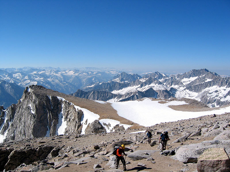
The views from the summit plateau were among the best I've ever seen. Views across the LeConte Canyon towards Black Giant and the Ragged Spur, a great view of the Palisades, and distant views of Kings Canyon and the entire southern Sierra range. We arrived on the summit at 9:30, and spent about 45 minutes on top, soaking in the views and taking loads of photos.
The trip down and back to the car was a typical slog, with some fun glissading down the chute to keep things interesting.
Above Baboon Lakes
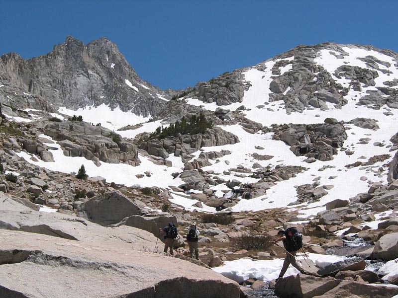
Sunset Lake and Point Powell

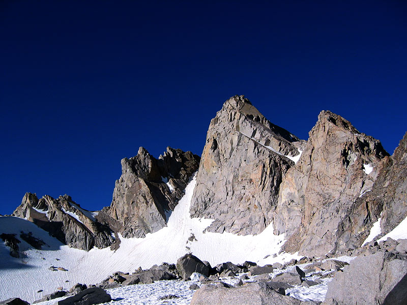
Point Powell from Thompson Moraine
Climbing the Couloir
On the Summit Plateau
Glissading to Sunset Lake
Hiking along Sunset Lake