Kennedy Meadow Trailhead
Revised October 2005 - please send updates to the webmaster
For how to reach Kennedy Meadows, please see the Sherman Pass description
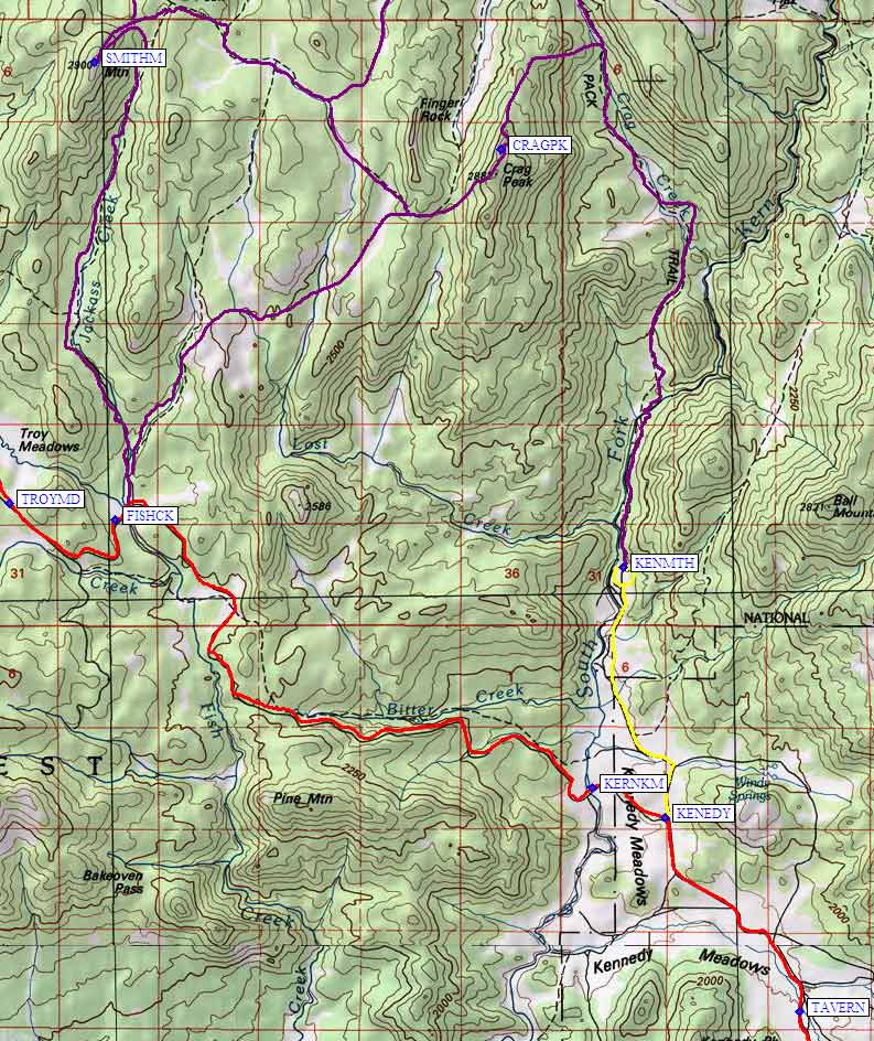
Kennedy Meadow is normally referred to as a place to drive through on your way to somewhere else. The 3-mile-long yellow line on the map below is how you get from the Kennedy Meadow general store (waypoint KENEDY) to the Kennedy Meadow Trailhead, one of the ways to approach Crag Peak. You can get a meal or a beer at the local bar (waypoint TAVERN), or use either the Kennedy Meadow trailhead (waypoint KENMTH) or the Fish Creek trailhead (waypoint FISHCK) to climb Smith and Crag.
For more details about stuff on the red line (Nine Mile Canyon Road, Kennedy Meadows Road,
Sherman Pass Road) refer to the Sherman Pass
description. Purple lines are hiking routes, not roads.
Useful Links:
Kennedy Meadow area map: