Mount DiabloArea
Revised 25 May 2015 - please send updates to the webmaster
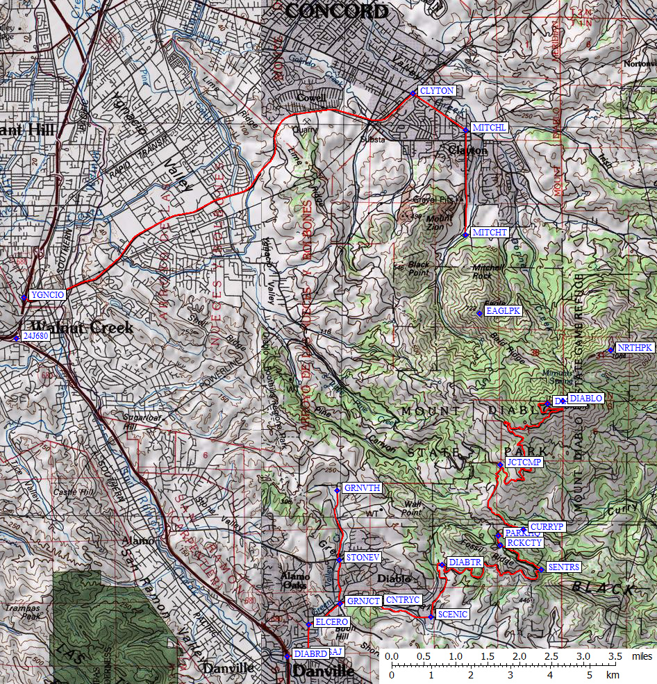
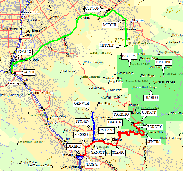
There are three trailhead GPS routes in this file, plus one 'route' containing the three highest peaks on Mt Diablo: Mitchell Canyon, Green Valley, Rock City, and local peaks. More detailed maps and descriptions are below this overview:
Get across to 680 and take the Ygnacio Valley Road exit (waypoint YGNACIO)
one exit north of Highway 24 (waypoint 24J680). Follow Ygnacio Valley Road
into the town of Clayton, then make a right on Clayton Road (waypoint CLYTON).
Make your next right south onto Mitchell Canyon Road (waypoint MITCHL).
At the south end of Mitchell Canyon Road is a trailhead (waypoint MITCHT)
near the ranger station. You'll probably have to pay for parking.
Get on I-680 about halfway between I-580 and Hwy 24, and take the
Diablo Road exit (waypoint DIABRD). This road turns left and then
right (at waypoints TASSAJ and ELCERO) - don't be fooled into
going straight on Tassajara or El Cerro or Ackerman: follow the
signs for Diablo even though it looks like you're turning onto
something else.
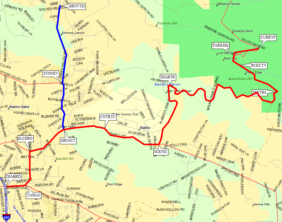
Turn north at Green Valley Road (waypoint GRNJCT) if you're
going to that trailhead (waypoint GRNVTH).
Most people will continue on Mt Diablo Road
past the country club (waypoint CNTRYC) to a stop sign at the
left turn marked 'Mt Diablo Scenic Blvd' (waypoint SCENIC).
Go left (north) along a residential country road until you come to the marked but
easy-to-miss Mt Diablo Summit Trail (waypoint DIABTR)
just inside a gate at the park boundary.
There is no parking anywhere outside the park (heavily signed) and there is no
parking anywhere near this trailhead inside the park! Apparently you must walk
from your home to use this trail, visitors are not welcome, but it connects to
Rock City and Green Valley if you can get to it.
For Rock City and/or the road to the summit, go to the south entrance station
(waypoint SENTRS) where you pay $10/day at the ranger
station (waypoint PARKHQ) whether or not it is manned.
Park at Rock City day use lot (waypoint RCKCTY) or
drive to Curry Point (waypoint CURRYP), which is past
the park headquarters on the road to the summit.
There is a water spigot (which was turned off as of 2015) at waypoint
RCKCTY and a couple of picnic tables there
at the road junction marked for Live Oak and Rock City picnic areas.
(The best picnic table is half a mile past the Rock City parking lot, has its own short
driveway from the pavement, and is basically only visible when driving downhill.)
From Rock City, walk along Fossil Ridge via a maze of small trails, or walk to
PARKHQ on pavement and join the Summit Trail there.
The Summit Trail repeatedly crosses the road as it follows the southwest
ridge to the top (waypoint DIABLO). There is a large
picnic area with overflow parking near the summit (waypoint DIABSP)
for those who would rather drive than hike!
Useful Links:
Mitchell Canyon trailhead (north side, route DIABLO MITCHELL CYN)

Green Valley trailhead (west side, route DIABLO GREEN VALLEY)
Rock City trailhead (south side, route DIABLO ROCK CITY)
All three trailheads and the three local peaks (route DIABLO PEAKS)